
Mapping a Path to Salmon Recovery in the Gualala River Estuary
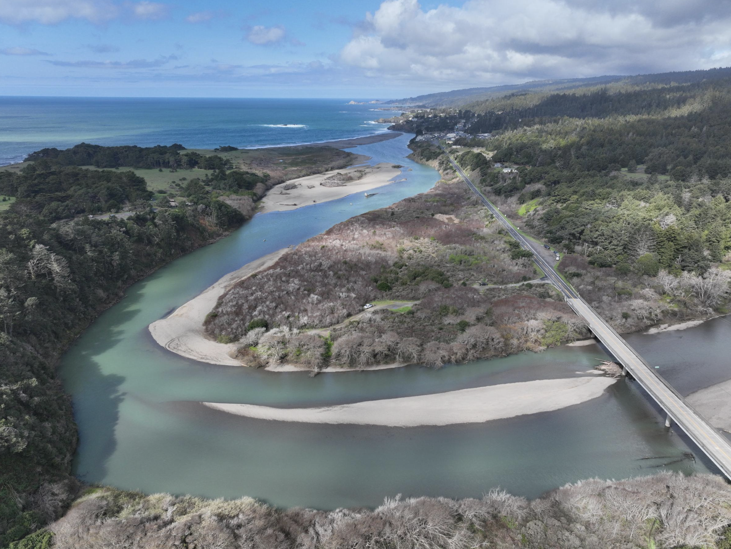
A new Story Map created by PCI’s design team showcases an ambitious vision to restore salmon habitat in the Gualala River Estuary, where the river meets the Pacific along the Sonoma–Mendocino county line. The Gualala River Estuary Salmonid Habitat Enhancement Planning effort takes a deep look at how this bar-built estuary has changed over time—and what can be done now to bring back the rich habitats young salmon need to survive.
Led by Redwood Coast Land Conservancy (RCLC) in partnership with Sonoma County Regional Parks (SCRP), and developed with science and engineering support from PCI Ecological, the project focuses on the 1.8-mile lower river and estuary within Mill Bend Preserve and Gualala Point Regional Park. Funded by the California Department of Fish and Wildlife’s Fisheries Restoration Grant Program, the work responds directly to state and federal recovery plans that identify the Gualala Estuary as a priority area for coho salmon and steelhead trout.
To understand how best to rebuild habitat, PCI installed monitoring stations in the estuary to track water levels, temperature, and salinity over multiple wet and dry seasons. This data, combined with high-resolution elevation mapping and a relative elevation model (REM), helped identify specific areas where wetlands could be re-established and where engineered large wood structures could most effectively improve habitat complexity.
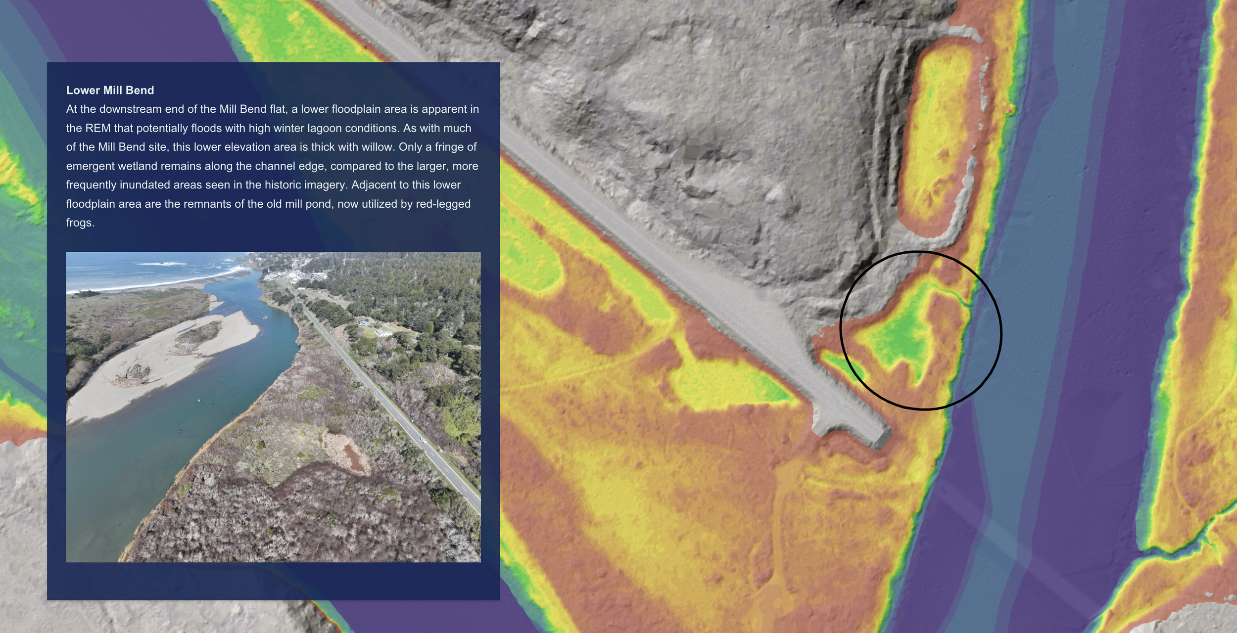
PCI completed an in-depth study of the estuary hydrology and surrounding floodplain terrain. This section of the interactive map walks viewers through this portion of the project.
The resulting Gualala River Estuary Salmon Habitat Enhancement Plan outlines a suite of on-the-ground opportunities, including:
New and expanded emergent wetlands in the lower estuary, Mill Bend, China Gulch, and near the Regional Park campground to provide feeding, rearing, and refuge areas for juvenile salmon and amphibians.
Off-channel alcoves and pocket wetlands that reconnect floodplains and deliver cooler freshwater inputs during key seasons.
Engineered log jams and large wood structures in the upper estuary to scour pools, slow high-velocity flows, create hiding cover, and increase food availability for both juvenile and adult salmon.
These actions are designed to be implemented in phases, offering a practical roadmap for restoring habitat while respecting existing infrastructure and public use.
A Story Map That Brings Science and History to Life
To share this work with the community and project partners, PCI’s design team created an interactive Story Map. Explore the Story Map here. Videos, maps, graphics, and aerial imagery created by PCI are presented alongside historic photographs from the Mendocino County Historical Society and modern satellite imagery, showing how the estuary has transformed over time. Interactive sliders allow users to compare past and present conditions and envision potential future configurations with restored wetlands and wood-rich channels.
Why This Matters
The Gualala River Estuary is a small system with outsized importance—for endangered coho salmon, for steelhead trout, and for the coastal community that values this landscape. The enhancement plan provides a science-based pathway to bring back complexity, cover, and productive feeding grounds that young salmon need to survive. The Story Map makes that science accessible, building transparency and understanding among agencies, landowners, and the public.
Together, the project and Story Map offer more than just a set of proposed actions—they tell the story of a river shaped by history, informed by new data, and poised for restoration.
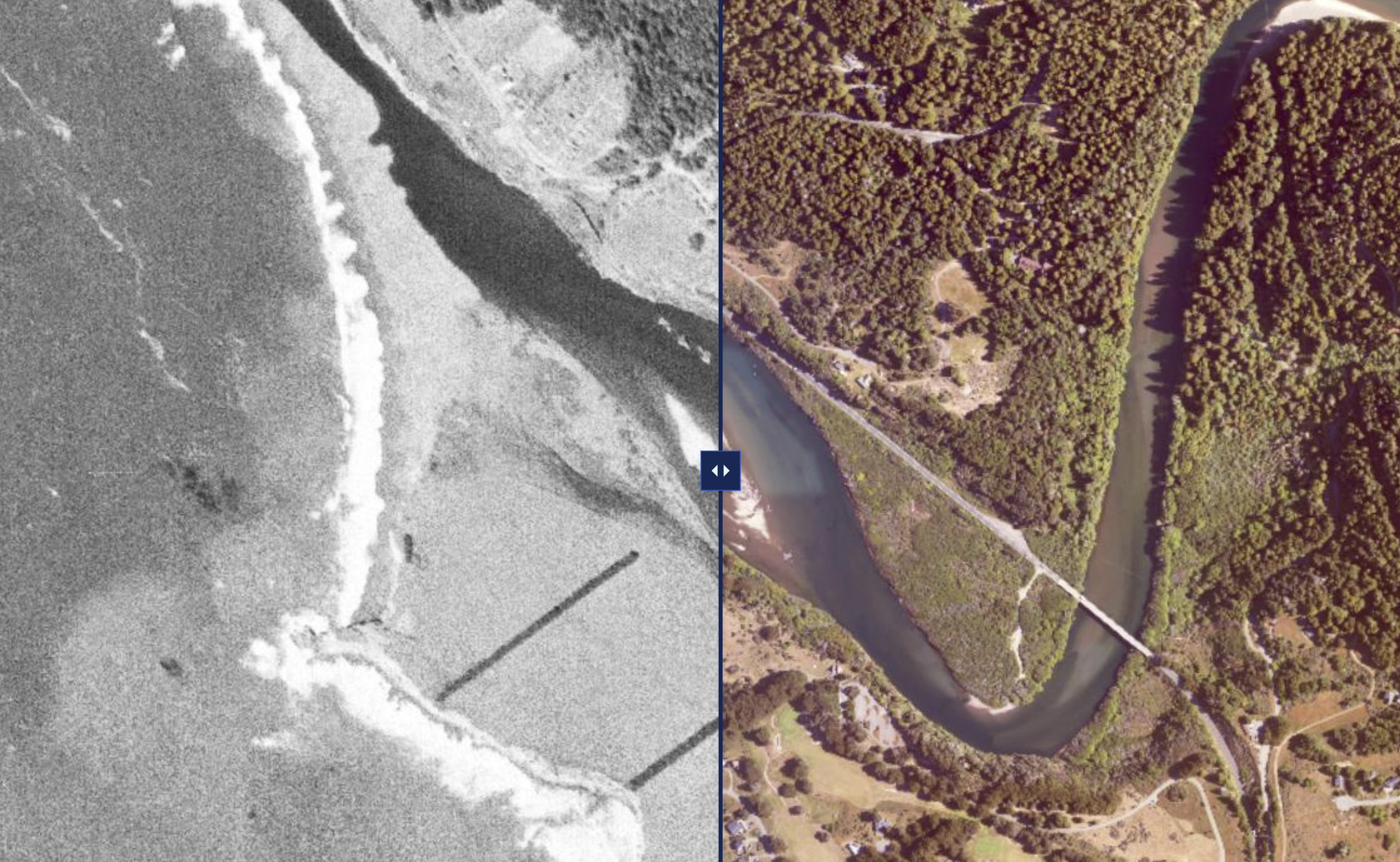
The new Story Map features a variety of interactive elements, like this “before and after” slider, which shows change over time.