
AFTER DECADES OF DISTURBANCE, A MARIN COUNTY WETLAND RETURNS
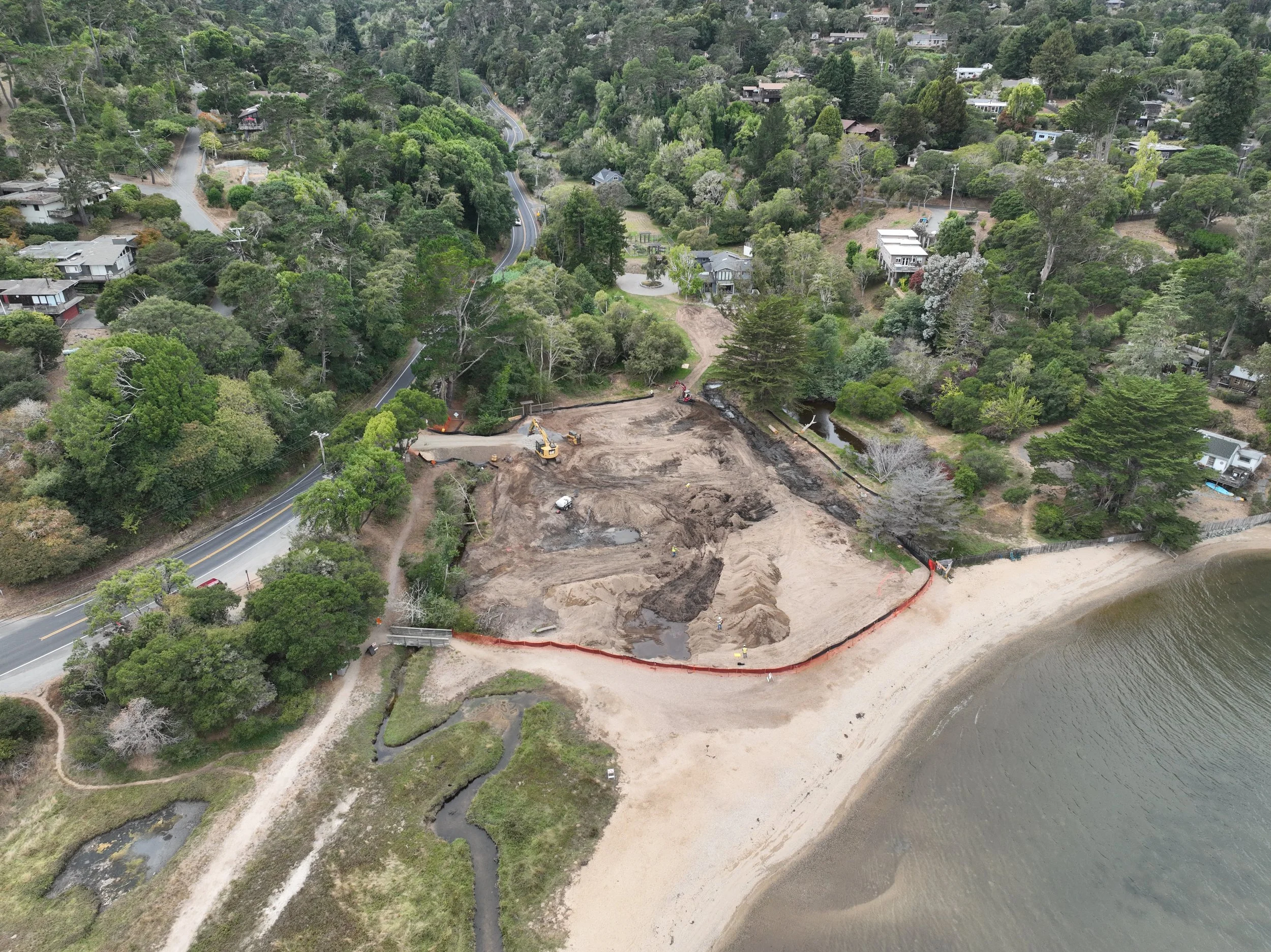
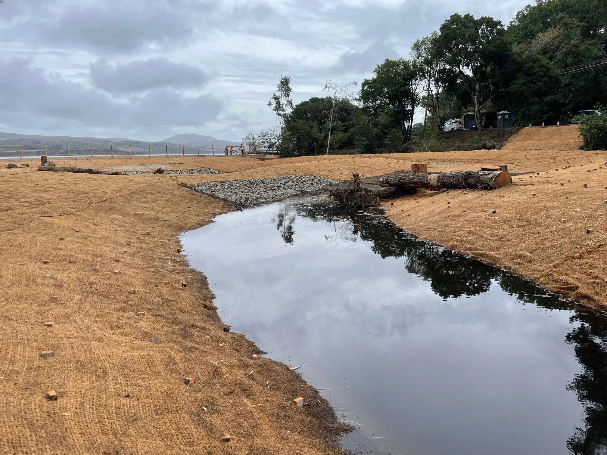
Project construction on September 4, 2025.
PCI and partners are nearing completion on a major effort to restore wetland, riparian, and aquatic habitats at Chicken Ranch Beach—one of Tomales Bay’s most visited public access points. The project is bringing back native ecological function, improving water quality at the popular swimming beach, and creating high-value habitat for sensitive species. This represents the culmination of a 20-year effort by the Tomales Bay Foundation (TBF) that is now coming to fruition.
Located just north of Inverness on the west shore of Tomales Bay, the project restores a coastal wetland long impacted by historic disturbance. PCI has worked with TBF throughout design, permitting, and construction to bring this enhancement to life.
A KEY SITE FOR RESTORATION
Chicken Ranch Beach is a popular Marin County Park, located on the shore of Tomales Bay in the community of Inverness, supporting beach recreation such as swimming and kayaking. It sits at the ecologically rich delta of Third Valley Creek, where perennial flows meet the Bay in a broad transition to shallow tidal marsh. The site was formerly a lagoon, which is now filled with fine sediment delivered by the creek during historic periods of watershed disturbance and by spoils from dredging a communication cable across the Bay in the 1950s.

1906 USGS photo of the Chicken Ranch Beach lagoon prior to filling.
The site has great potential to re-establish self-sustaining function to the ecological communities that inhabit the project area, including conditions for California red-legged frogs, tidewater goby, and western pond turtles in the wetland complex and saltmarsh common yellowthroat and California giant salamander in the restored riparian zone along Third Valley Creek.
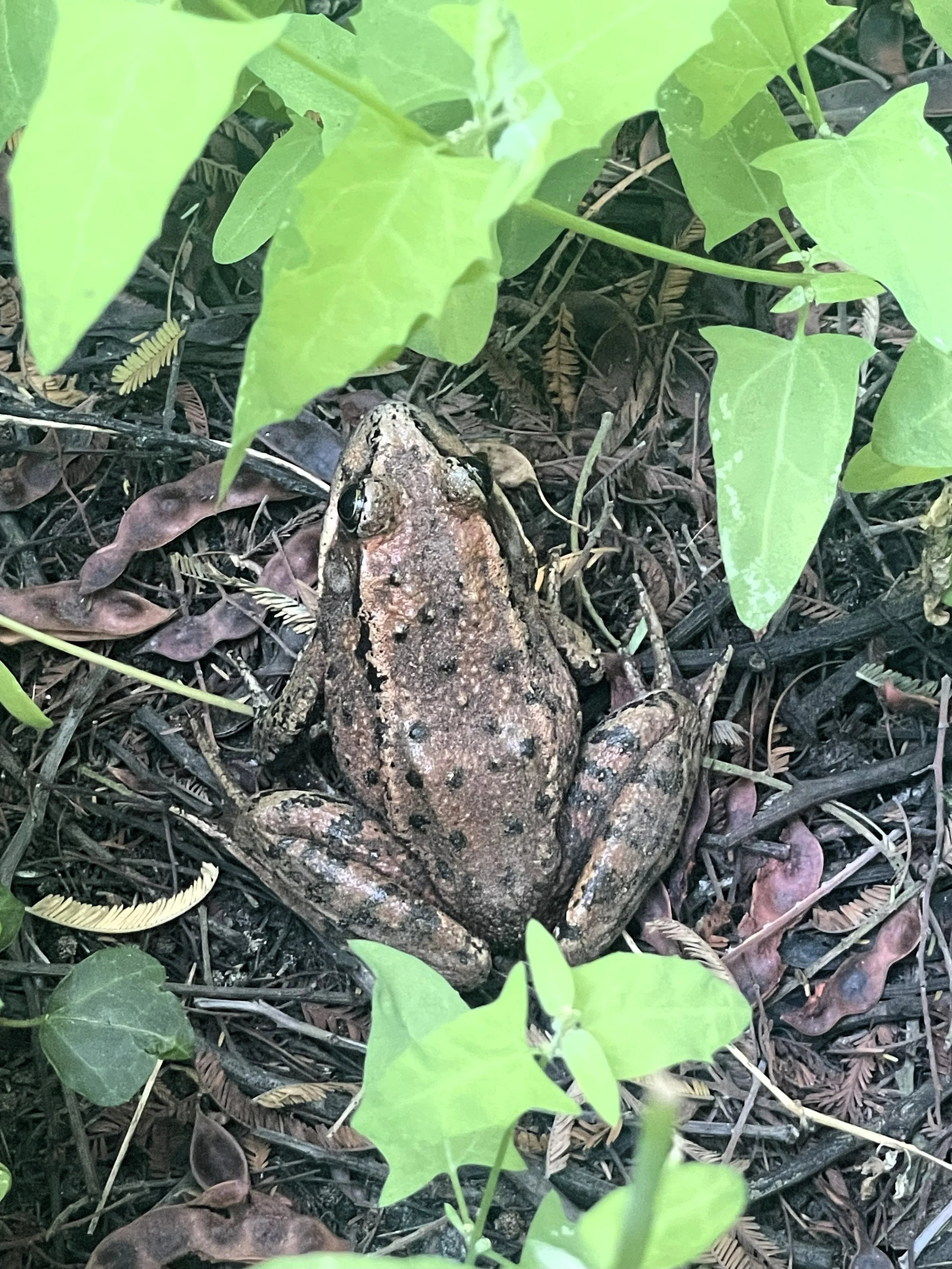
California Reg Legged Frog. Photo Credit: PCI Ecological
Unfortunately, for many years, a constructed drainage ditch (“Channel B”) has conveyed water with high bacterial counts through the site, discharging to the public beach. Water samples from both Channel B and Tomales Bay along the beach have exceeded standards for human recreational contact (swimming) for many years.
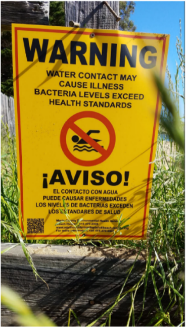
Health warning for bacterial concentrations .
DESIGN GOALS AND FEATURES
The Chicken Ranch Beach Wetland Enhancement Project brings long-needed ecological function back to the delta of Third Valley Creek by restoring hydrology, creating high-value habitat, removing invasive species, and establishing a diverse native plant community. Together, these improvements expand wetlands and shallow pools, filter runoff before it reaches Tomales Bay, and build resilience to sea-level rise—all while enhancing the public beach experience for visitors.
HYDROLOGIC RESTORATION
A central component of the project is re-establishing natural water retention and slow flow across the site. Historical fill and accumulated sediment were removed, and Channel B—the ditch that previously conveyed bacteria-rich runoff directly to the beach—was filled. Flow is now routed through a restored wetland complex designed to filter and slow water, improving both habitat quality and conditions for public recreation.
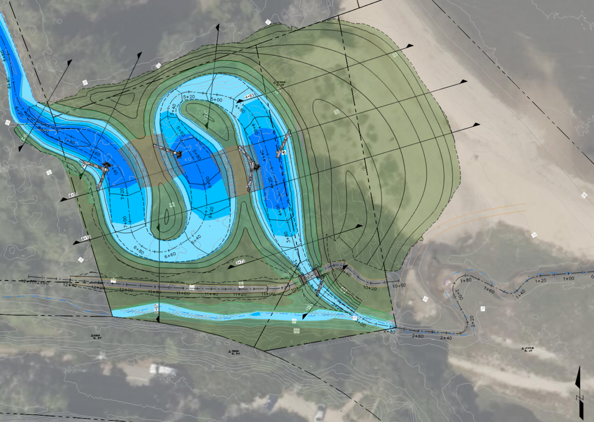
Project design showing a series of three wetland pools for habitat value and water quality improvement. Sand lenses were added to encourage groundwater flow between pools and help reduce bacterial loads.
HABITAT CREATION
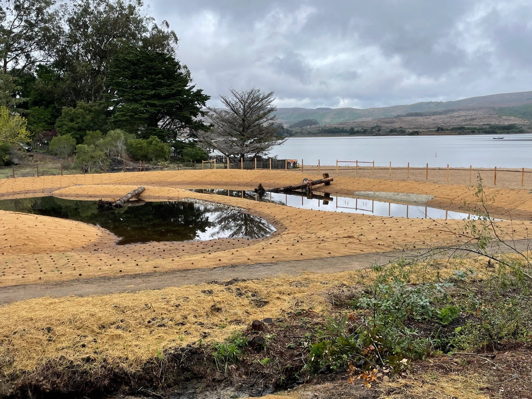
The restored wetland complex incorporates a mosaic of shallow pools, basking logs, open-water habitat, and sandy substrate. These features provide essential breeding, refuge, and foraging areas for species including California red-legged frog, western pond turtle, tidewater goby, saltmarsh common yellowthroat, and California giant salamander. As water levels rise and fall seasonally, the habitat will continue to evolve and diversify.
Log structures in the upper pool of the restored wetland during the construction period. The cobble area on the left is one of the sand lenses included to help reduce bacterial loads.
INVASIVE SPECIES REMOVAL
Before restoration, much of the site was dominated by dense stands of non-native acacia that shaded out native vegetation and limited wildlife use. These trees were carefully removed to make space for more diverse plant communities and to restore natural light, moisture, and soil conditions across the site. Removing these non-native trees created the space and conditions needed to re-establish a diverse native plant community.
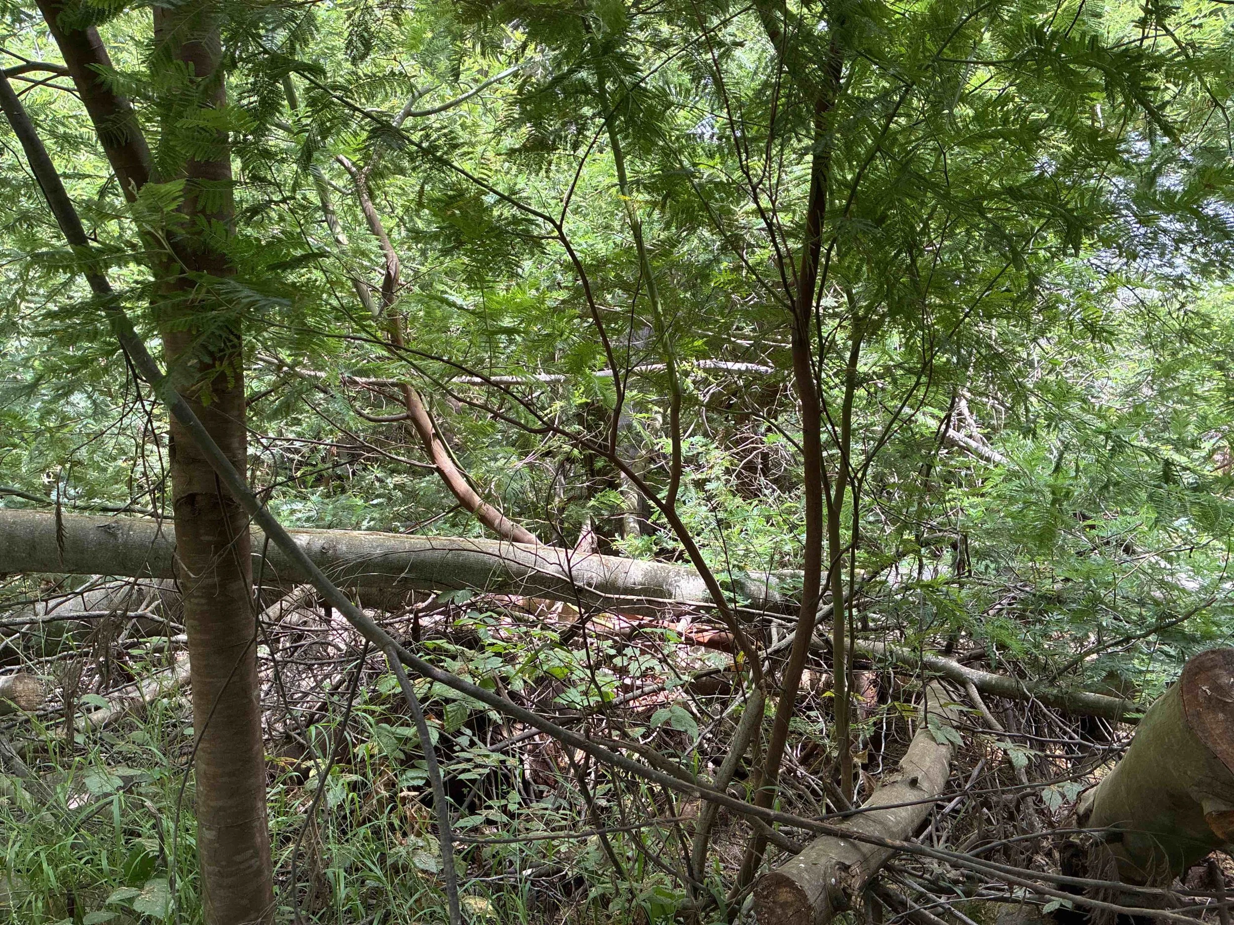
Non-native acacia forest that formerly dominated much of the site.
PLANTING OF NATIVE WETLAND & RIPARIAN COMMUNITIES
Nearly 8,000 plants native to the coastal Marin region are now being installed to rebuild wetland and riparian ecosystems. This plant palette provides long-term stability, habitat value, and visual beauty for this popular Tomales Bay destination.
CLIMATE & SEA-LEVEL RISE RESILIENCE
The redesigned topography and connected wetland pools help the site adapt to future tidal changes and gradual sea-level rise. By enhancing existing sand dunes and hydrologic pathways, the project supports marsh migration, maintains habitat connectivity, and strengthens the shoreline’s resilience in a changing climate.
PROJECT CONSTRUCTION
Construction began in mid-August 2025 with Conservation Corps North Bay clearing the acacia trees from the site. Glissman Excavating continued with earthmoving, site features, and erosion control, completing their work in mid-October. Turtle Island Restoration Network is currently working to plant nearly 8,000 native plants on the site.

PCI provided construction management services throughout the project. Christopher Woltemade, Principal Hydrologist, and Fiona Connor, EIT, managed the construction phase. Photo credit: Tom Gaman, Tomales Bay Foundation.
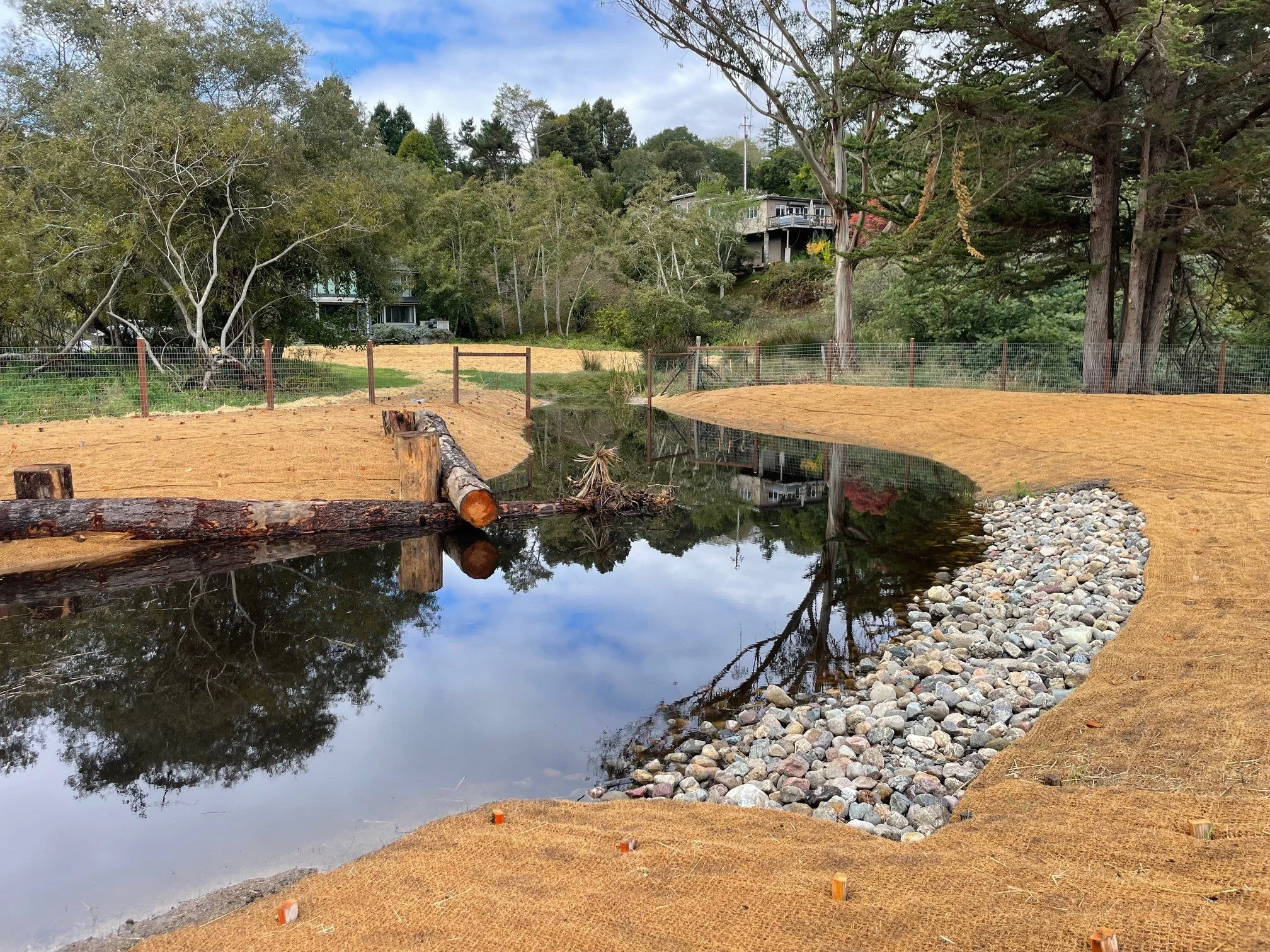
Wetland pools began to fill with water during October 2025, near the end of project construction.
Channel B, which formerly conveyed flow with high bacteria counts directly to the public beach, was filled and the flow redirected into the restored wetland area for water quality treatment.
Channel B prior to restoration, looking East toward Tomales Bay.
Flow from the former Channel B is now routed into the wetland areas to support habitat and improve water quality.
WHAT’S NEXT
We look forward to seeing this project evolve through planting during winter 2025-26 and the ecological response that will unfold over the coming seasons. PCI will continue to support these efforts through post-implementation monitoring.
PCI’S COMMITMENT
This project reflects PCI’s interdisciplinary approach to ecological restoration—integrating hydrology, engineering, landscape architecture, and ecological planning to create resilient, natural systems. We are proud to support the Tomales Bay Foundation in bringing this long-anticipated project to completion.
FUNDING PARTNERS
The Chicken Ranch Beach Wetland Enhancement Project was made possible with funding and support from:
U.S. Fish and Wildlife Service National Coastal Wetland Conservation Program
California State Coastal Conservancy
Marin County Measure A
Tomales Bay Foundation
Conservation Corps North Bay